.post-timestamp{display:none;}

Colebrook, Tas: Remnants Of a Convict Station

Colebrook, situated in the Coal River Valley in the Southern Midlands of Tasmania, is 39km north from Hobart.

The town was called Jerusalem, then Colebrook Dale and afterwards became Colebrook, with historic buildings, such as the Police Station and Colebrook Courthouse, built in 1834.

Oyster Bay People ((Paredarerme)

The land of the Oyster bay People covered the east coast from St Patricks Head to the Derwent estuary and Tasman Peninsula, to the mouth of the Jordan River and inland to St Peters Pass in the midlands, east to the Eastern Tiers, and northeast back to St Patrick’s Head. 

The Oyster Bay people moved about according to the season and food availability, collecting ochre, making stone tools, collecting reeds and grasses for baskets making.

Many Aboriginal people practised scarification of the skin for reasons such as, identity and status, grief and patterns showing tribal affiliation.

Francois Peron, part of a French expedition, visited Tasmania in 1802 as naturalist on the Geographe, making drawings of Aboriginal people. He reported that pieces of bark covering a burial mound at Oyster Bay had "some characters crudely marked," similar to those which the aborigines tattooed on their" forearms".
John glover, danza d'indigeni della terra van diemen (tasmania) al chiar di luna, 1831-45 ca. Sailko
John Henry Cox, an English explorer, visited Oyster Bay in the Mercury in July, he reported that several Aboriginal people were  "tatowed in a very curious manner, skin being raised so as to form a kind of relief (Mortimer, 1791).

According to Jørgen Jürgensen, 1780, a Danish convict, the Oyster Bay people made "ring dollars" in the small of the back. 

By the early 1830s, the thirty-year conflict between the Tasmanian Aboriginal people and the European settlers was coming to an end. Warfare and disease, to which they had no immunity, had severely reduced Aboriginal populations.

By 1833, George Augustus Robinson, Chief Protector of Aborigines, befriended Truganini and made an agreement with the Big River and Oyster Bay peoples to move to Wybalenna Aboriginal Establishment on Flinders Island.

Shortly after arriving, the 14 Aboriginal children, aged between six and 15 years, were sent to live with the storekeeper and the catechist. (1.)

In 1848 some settlers around Huonville remembered, visiting Oyster Cove Aboriginal people who had been transported in 1847 from Wybalenna, whitening their faces when performing corroborees, to frighten the rain away. Here
Oyster Bay People, Flinders Island, TAS
William Blythe, who was interviewed 19 January, 1909, was told by eyewitness that in 1847, he saw Aboriginal people make fire twirling a stick. "They would put the spear point in the hard wood, and two or three would twirl it in their hand. Another way is to work a hard pointed stick in a groove in a flat wood; I can get the smoke and then I am knocked out; don't know where I heard they did this second way." Here

1800s

In 1806, with severe food shortages in Hobart, soldiers were sent into the Colebrook area to hunt game. On this expedition, Private Hugh Germain, an educated member of the Royal Marines, bestowed names to various sites, such as Bagdad, Lake Tiberius, Jericho, the Jordan River and the Jerusalem Plains.

It is thought that the Seven Hills surrounding the town inspired the name Jerusalem. The railway station, that burned down in 1967 had a Star of David in the fretwork.

1820s

Andrew Tolmey was granted land at Colebrook Park in 1828, buiding a house by 1831.

1830s

The Police Station and Colebrook Courthouse were built circa 1834.

Colebrook began as a Convict Probation Station to house convicts being moved between Richmond and Oatlands, and was known as Jerusalem.

Part of a larger grant to Tasmania’s Governor Arthur, the property was known as Jerusalem Estate.

The original Hospital in the Jerusalem Probation Station dates from 1835. The building was designed and surveyed by the Royal Engineers and constructed with convict made materials and labour. There are remnants of a the convict prison cell downstairs.

Colebrook was developed as a convict probation station in 1839. The probation system replaced the assignment system, but this experiment was unsuccessful.

1840s

The building of the Jerusalem Probation Station began in 1841, one of 75 probation stations established across Van Dieman’s Land. This system of reform entailed labour and religious instruction, which could lead to a probation pass and perhaps eventually qualifying for employment by free settlers. 
Courier (Hobart, Tas. : 1840 - 1859), Friday 15 July 1842

1850s

The perimeter walls of the probation station were demolished in the 1850s.

"The Chimneys" was the home of the district constable in early 1854. However, In July 1854, it became a convent until closing in 1967.

Construction of St Patrick’s Catholic Church began in 1855, one of three churches in the State designed by Augustus Welby Northmore Pugin.

1860s

Mercury (Hobart, Tas. : 1860 - 1954), Tuesday 3 July 1860
Mercury (Hobart, Tas. : 1860 - 1954), Wednesday 3 October 1860

1870s

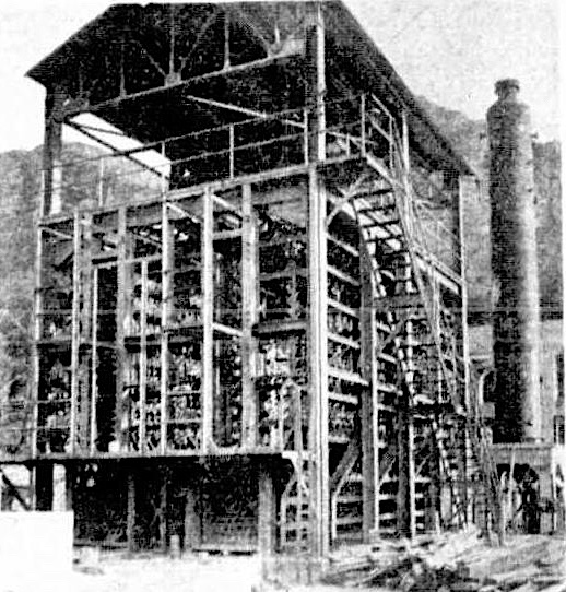
Hardwick Mill was operating in 1871. The building was originally constructed as a steam flour mill

Jerusalem Probation Station’s Church was used by the Anglican Church until the 1870s.
Weekly Examiner (Launceston, Tas. : 1872 - 1878), Saturday 2 December 1876

1880s

The building of St. James Anglican Church ("The Old Prison Church") began in 1882.
Mercury (Hobart, Tas. : 1860 - 1954), Monday 6 November 1882

1900s

Mercury (Hobart, Tas. : 1860 - 1954), Wednesday 30 November 1904
Railway Hotel, Colebrook, TAS, 1908

WWI

Archie Albert Barwick (7 March 1890 – 28 January 1966) was born at Colebrook, TAS, was an Australian farmer and soldier known for his diaries of World War I. His set of diaries are recognised as one of the most extensive and well written first hand accounts of military service in World War.
Archie Albert Barwick (7 March 1890 – 28 January 1966) was born at Colebrook, TAS. was an Australian farmer and soldier known for his diaries of World War I. His set of diaries are recognised as one of the most extensive and well written first hand accounts of military service in World War. 
Unit 1st BattalionBattles/warsWorld War I:Gallipoli Campaign..Egyptian Campaign. Flanders Trenches Campaign. Somme 1916 Campaign. Hindenburg Line Campaign. Ypres 1917 Campaign. German Offensive Campaign. AwardsBelgian Croix de Guerre
Our Colebrook correspondent writes:— "Very much sympathy is felt for Mr. and Mrs. W. E. Smith, of Green Hills, Colebrook, who received news quite recently of the death of their son, Corporal Claud Smith, on the Western front. He had been previously wounded in action there, but recovered. Corporal Smith joined the A.I.F. about 2½ years ago, saw active service at Gallipoli, and thereafter, with his regiment, was transferred to France. He is the second son of the same family to be mortally wounded in action. Private Keith Smith was killed in action there about 15 months ago. Mr. and Mrs. Smith had four sons, and all joined the A.I.F. when the call to arms reached them. Privates Frank and Iven are still on active service in France." Mercury (Hobart, Tas. : 1860 - 1954), Thursday 25 October 1917

1920s

Harvest Time at Colebrook, TAS, Mercury (Hobart, Tas. : 1860 - 1954), Wednesday 11 April 1923

1930s

ST. JAMES' CHURCH, Colebrook, which was opened for divine service on March 13, 1884, by Bishop Sandford. On the right is the "Old Prison Church " a brick building with freestone base, erected in 1834 by the British Government in pursuance of its penal system, and used for church services until St. James' Church was opened. The late Captain R. Storey licensed it for concerts and dances in 1900, when it became known as Waterdale Hall. This ancient structure is now private property. Mercury (Hobart, Tas. : 1860 - 1954), Tuesday 13 March 1934
The Prince meets returned men at Colebrook. Highness was greeted with rousing cheers. Examiner (Launceston, Tas. : 1900 - 1954), Saturday 17 November 1934 (royal visit of Prince Henry, Duke of Gloucester)

1940s and WWII

Founded in 1840 by a Mr. Denn, and purchased by the late Mr. Alfred Nichols, father of the present owners, Misses M. and C. Nichols, about 70 years ago, this fine freestone structure, comprising a general store and residence, situated at the corner of Main St. and Rhyndaston Rd., Colebrook, is in a good state of preservation. Mercury (Hobart, Tas. : 1860 - 1954), Friday 23 February 1940
Mercury (Hobart, Tas. : 1860 - 1954), Wednesday 24 March 1943
Five generations of the Marney family, of Colebrook: Mr John Marney, Mr H. Marney (son), Mrs J. T. Beven (grand-daughter), Mrs B. Williamson (great-grand-daughter), and baby Jennifer Williamson (great-greatMercury (Hobart, Tas. : 1860 - 1954), Monday 27 August 1945
Colebrook Football Team. Tasmanian Archives: No date

1950s

  Gangs lost no time in starting repairs to the permanent way after the fatal Colebrook rail smash. Mercury (Hobart, Tas. : 1860 - 1954), Monday 29 October 1951
IF you have thousands of acres of land to fertilise, the use of aircraft, depicted here, is the most economical method. If the country is hilly, like this Colebrook property of Mr. L C Reynolds, it is the only woy, because you can't spread fertiliser on steep hüls by any other means. Mercury (Hobart, Tas. : 1860 - 1954), Wednesday 30 July 1952

1960s

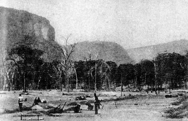
Colebrook was almost completely destroyed by the fires on February 7, 1967. One side of the street was virtually wiped out.

On person died in the fires, as well as many farm animals. Also lost were the, state school, post office, the Railway Hotel, the two shops and many houses.

1980s

Colebrook Park, a two-story Georgian sandstone house built in 1822 was lost with the building of Craigbourne Dam which opened in 1986.

2000s

The Southern Midlands Council approved a development application for a Benedictine monastery to be built at Colebrook in 2019. The Monastery, known as Notre Dame Priory, will be located at Hardwick House, 2495 Colebrook Road, Colebrook.
Road to Hobart Town, TAS

Around Colbrook


Original Hospital in the Jerusalem Probation Station c.1835, Colbrook, TAS. The building was designed and surveyed by the Royal Engineers, and used with convict made materials and labour. There are remnants of a the convict prison cell downstairs.
Construction of St Patrick’s Catholic Church began in 1855, one of three churches in the State designed by Augustus Welby Northmore Pugin, Colebrook, TAS
Richmond street, Colebrook, TAS, built by convicts around 1840, part of the downstairs was once an old store and butcher shop (Nichols' Store 34. Richmond St Colebrook)
Colebrook, TAS - St James of Jerusalem Anglican. Year Built: 1884
Colebrook Road, Colebrook, TAS, built 1840
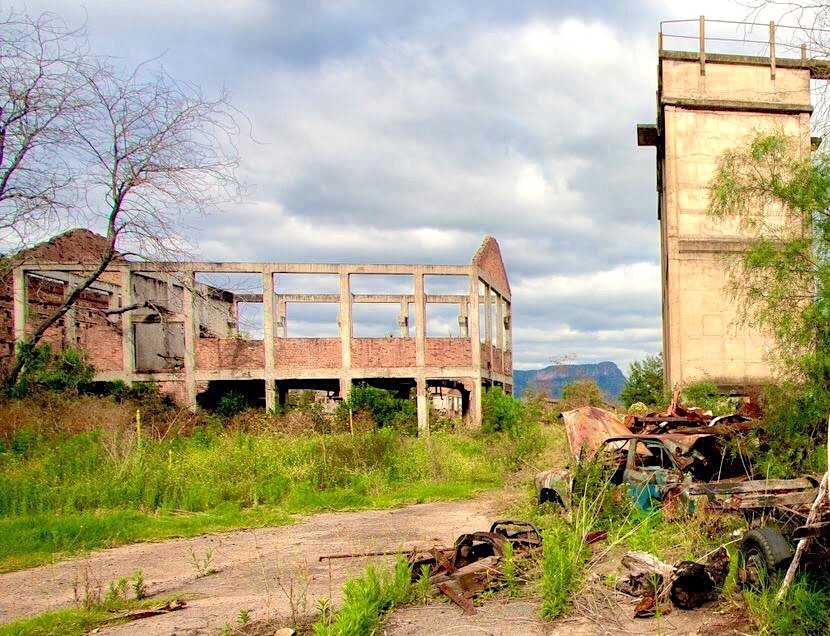
 Ruins, Rhyndaston Road, Colebrook, Tasmania, Australia
Old Colonial brick store (Nichols Store) and associated buildings, Colebrook, TAS
The Colebrook History Room is located on the former school site, TAS
The Police Station and Colebrook Courthouse, TAS, was built circa 1834


Things To Do and Places To Go

Colebrook History Room

The great North Walk: Sydney To Newcastle, NSW

The Great North Walk is a 270.4-km walk from Sydney to Newcastle. Generally considered a challenging route, through bush, suburbs and the coast, it takes an average of 76 h 12 min to complete.

The entire walk from Sydney to Newcastle takes between 8 and 14 days to complete and is well sign-posted. Individual sections can be completed as day walks.

The Great North Walk starts in Macquarie Place, Sydney (near Sydney Cove). Macquarie Place was established in 1810 as Sydney's original "town square".

Walk a series of connected tracks through Lane Cove National Park, Ku-ring-gai Chase National Park, Brisbane Water National Park and Watagan State Forest.

The walk was created in 1988 to celebrate Australia's bicentennial year.
Obelisk in Macquarie Place, Sydney, NSW, erected in 1818
1 Sydney to Boronia Park, 2.5 hours, 6 km.
2 Boronia Park to North Ryde, 2.75 hours, 7.2 km.
3 North Ryde Fairlands Circuit, 2.5 hours, 6.9 km.
4 Roseville to Macquarie Park, 3.5 hours, 8.8 km.
5 Macquarie Park to Thornleigh, 4.5 hours, 11.5 km.
6 Thornleigh to Hornsby, 4 hours, 10.2 km
7 Hornsby to Galston Gorge, 3.5 hours, 8.2 km
8 Galston Gorge to Mt Kuring-gai, 5.5 hours, 12.6 km
9 Mt Kuring-gai to Berowra, 4.25 hours, 9.7 km
10 Berowra to Berowra Waters, 2.75 hours, 5.7 km
11 Berowra Waters to Cowan, 3.5 hours, 7.2 km
12 Cowan to Brooklyn, 5.5 hours, 13.4 km
13 Patonga to Wondabyne, 7.5 hours, 19.5 km
14 Wondabyne to Mooney Mooney Creek trackhead, 4.25 hours, 10 km
15 Mooney Mooney Creek Trackhead to Somersby, 6 hours, 16.1 km
16 Somersby to Ourimbah Valley Trackhead, 2.5 hours, 6 km
17 Ourimbah Valley Trackhead to Greta Road, 5.5 hours, 15 km
18 Brumble Hill Dray Track Greta Road to Yarramalong, 2.75 hours, 5.6 km
19 Yarramalong to Cedar Brush, 3.5 hours, 11 km
20 Cedar Brush to Basin Campsite, 4.5 hours, 9.7 km
21 Basin Campsite to Watagan Creek Road, 6 hours, 13 km
22 Watagan Creek Road to Flat Rock Lookout, 2 hours, 4.1 km
23 Flat Rock Lookout to Congewai Valley East trackhead, 5 hours, 13.8 km
24 Congewai Valley East trackhead to Watagan HQ, 7 hours, 17.1 km
25 Watagan HQ to Heaton Lookout, 4 hours, 8.1 km
26 Heaton Lookout to Heaton Gap, 2 hours, 4.3 km
27 Heaton Gap to Teralba, 6 hours, 14.8 km
28 Teralba to Charlestown, 4.5 hours, 13.3 km
29 Charlestown to Merewether, 2.75 hours, 7.9 km
30 Merewether to Newcastle, 1.5 hours, 4.4 km

The walk officially begins in Macquarie Place, going through Hunters Hill, with its many heritage homes, to the Lane Cove River. Then follow the river into the Lane Cove National Park to Thornleigh, then along Berowra Creek. The track continues into the Ku-ring-gai Chase National Park, coming to Brooklyn on the Hawkesbury River. 
Hunter's Hill, Great North Walk, NSW
City views, Great North Walk, Sydney, NSW
The Great North Walk passes through Lane Cove National Park, NSW
Boronia Park has a rich cultural history that includes Aboriginal and European heritage items. The registered Aboriginal archaeological sites include axe-grinding grooves, rock engravings, hand stencils, middens, shelters with art, burial sites and wells. An area called the Field of Mars Common was set aside by Governor King in 1804 for the use of the local community. Items of European cultural and historical significance in Boronia Park include the grandstand, horse trough, hand hewn sandstone in the Brickmakers Creek Wetland and the broad arrow marking for the Field of Mars Common survey. There are also remnants of past infrastructure onsite, including the site of the former wharf at Princes Street for produce transport, site of the tannery and the remains of a boatman’s cottage.
Boronia Park to North Ryde, Great North Walk, NSW
Berowra Waters Aboriginal Engraving: (33° 35′ 49″S, 151° 7′ 32″E) on the Great North Walk track, NSW
Crossing the river by train or boat, the walk then continues north through Brisbane Water National Park and the Ourimbah Valley, then reaching the Watagan State Forest.

Further north, the track turns east to the Brunkerville area, following the Myall Range for some time before coming to Teralba, on the southern fringes of Newcastle. Continue on the track to the official finishing point in Newcastle.
Direction, The Great North Walk, NSW
The section of the Great North Walk begins near Somersby General Store and continues north into the Jilliby State Conservation Area 
Jerusalem Bay track, from Cowan Station to Hawkesbury River, near Brooklyn, NSW (Great North Walk)
Girrakool Loop tracks, Great North Walk, NSW
Girrakool rock art, NSW
There are designated camp sites along the way, however some have no available water supply. 

Booking is required for most sites and if you plan to stay at a Crown Land campground you need to fill out a reservation form.

View Aboriginal rock art along the way.

Some parts of the walk are challenging, while others are easy.
The great North Walk: Sydney To Newcastle, NSW
Great North Walk: Watagan Creek Road to Flat Rock, NSW
Wheel from the coal railway. This part of the Great North Walk begins at a park in Charlestown, NSW, continues though bush reserves and along a Burwood Beach, past the heads to Merewether Beach, Glenrock lagoon on the Yuelarbah Track, including the Leichhardt’s Lookout
Merewether, Bathers Way, NSW.  Great North Walk
Stroll through Newcastle CBD. NSW, Great North Walk
Finish!
Queens Wharf, Newcastle harbour, near Newcastle CBD

More Information


Blog about competing the walk here

Walking guide here

Blog here

From suburbia into bushland

Great North Walks Short Walks Maps


Information on campgrounds and places to stay for the Great North Walk


Glen Davis, NSW: Ruins in The Capertee Valley,

Glen Davis is an almost abandoned shale mining town located 70 kilometres north of Lithgow in the Capertee Valley, NSW.

Today the abandoned village is located in Wollemi National Park and can be visited by tourists.

The Wiradjuri People (variety of spellings)

Wiradjuri is derived from wirraay, meaning "no" or "not", with the comitative suffix -dhuurray or -juuray, meaning "having".

Aboriginal people were hunters and gatherers, which required complex knowledge, skills, and practices that are fundamental to religious beliefs and rituals. 

 Norman Tindale wrote that Wiradjuri was one of several terms coined, later after the 1890s.

The Wiradjuri are the people of the three rivers (bila), and their country (nguram-bang) is the second largest in Australia.

These rivers are Macquarie River (Wambuul), Lachan River (Galari), and Murrumbidgee River (Marrambidya).
Tree Carvings and Ground Drawings at Bora Camp, Mathews, R. H. - File:Notes on the Aborigines of New South Wales, 1907
The Goanna (Gugaa) is the major totem of the Wiradjuri people. Ordinary totems inherited matrilineally (from mother) were called djindji translated as "meat".

Clever men were experts in stories and spiritual beliefs relating to Baime (important creator being). Clevermen were similar to shamans, using songs, quartz crystals and emu feathers in rain-making rituals. Clever people could also travel to the sky to release the rain (Berndt 1947).

Wiradjuri clevermen used human hair cords to extract poison or to kill. Clevermen were guided and protected by their totem.

The powerful Rainbow serpent (Wawi) is often seen as the creator God. The rainbow serpent is the rainbow itself and is said to inhabit particular waterholes and rivers. Quartz crystal and certain seashells are also associated with the Rainbow Serpent, as the refraction of light creates a rainbow.

The Rainbow Serpent came from under the ground, creating mountains and valleys as it pushed upward. Thunder and lightning are said to occur when the Rainbow Serpent is angry.
Aboriginal people
Wiradjuri people wore Possum skin cloaks for warmth and used them as baby carriers. The cloaks were made from many possum pelts sewn together with kangaroo sinew. They were often etched with mussel shells, possum jawbones or kangaroo incisor teeth.

The Wiradjuri were known for their use of carved trees marking the burial site of notable men of the tribe.
 
Wiradjuri and British people became involved clashes as they had different ideas of what constituted property.

1820s

From 1820s, European settlers began farming and agriculture in the Capertree Valley.

1860s

Around 1865, oil shale was first discovered in the northern side of the Capertee Valley by local farmer, Mr. B.R. McLean.

1880s

The first mining tunnel was established in 1881.

1890s

The first shale oil lease was granted in 1891 to MPI Mining Development.

1930s

A report in 1934 by the Newnes Investigation Committee investigated ways to decrease the number of unemployed miners in the region.


The Commonwealth of Australia Gazette, on 28 May 1936, invited offers for developing the oil industry in the Glen Davis area.


National Oil Proprietary Limited was created with financial support from the Commonwealth and New South Wales governments, with Glen Davis chosen as the site.


Construction of the shale oil works started in 1938.

DIGGING THE FOUNDATION (Glen Davis, NSW) for ihe workshops in January, 1939, turning the first sods in the building of an industry and a town. Glen Davis today has a £25,000 modern hotel with hot and cold water, a shopping centre, a picture show, sports oval. Daily Telegraph (Sydney, NSW : 1931 - 1954), Sunday 4 August 1940
ELECTRIC DRILLS dig out the shale. The 4ft. seam at Glen Davis is twice as thick as it is over the mountain at Newnes, NSW. Daily Telegraph (Sydney, NSW : 1931 - 1954), Sunday 4 August 1940
The Processing Plant began in 1938, but there was no housing or facilities availible, so in the early days, many built their own hosing from hessian and whatever they could find. This is why an area of Glen Davis was known as “Bag Town”.

A town of 2000 people began to develop around the mine.
Mudgee Guardian and North-Western Representative (NSW : 1890 - 1954), Monday 2 October 1939
A general view of the modern plant in the course of construction at the Glen Davis, NSW, shale mine. Central Queensland Herald (Rockhampton, Qld. : 1930 - 1956), Thursday 14 December 1939
A section of the old oil plant at Newnes being demolished following the decision to transfer the oil-from-shale activities to Glen Davis. Central Queensland Herald (Rockhampton, Qld. : 1930 - 1956), Thursday 14 December 1939
A TRUCKLOAD OF SHALE leaving the mine for the dump. at Glen Davis, NSW, Australasian (Melbourne, Vic. : 1864 - 1946), Saturday 23 December 1939
ONE OF THE MOST MODERN CRACKING PLANTS, Glen Davis, NSW,  The world is being built at the works. This plant is used in one of the final refining products. Australasian (Melbourne, Vic. : 1864 - 1946), Saturday 23 December 1939
THE LOADING OF SHALE UNDER-GROUND. Glen Davis, NSW. A truckload about to be drawnout of the mine by the electric haulage plant. Australasian (Melbourne, Vic. : 1864 - 1946), Saturday 23 December 1939
 'PETROL FROM SHALE—PLANT GROWS AT GLEN DAVIS (N.S.W.) The Australasian (Melbourne) Sat 23 Dec 1939

1940s and WWII

During WWII, the shortage of petrol led to the Government reviving oil shale mining and treatment in 1940.
Sun (Sydney, NSW : 1910 - 1954), Thursday 29 August 1940
The school opened in January 1940.
Sir George Davis (left) and Premier Mair (right, visiting Glen Davis in July 1940) aboard an electric locomotive, with mine adit at rear. Sydney Morning Herald 6 July 1940
This is the present town of Glen Davis, NSW.-One of the many camp streets where workmen are living. Central Queensland Herald (Rockhampton, Qld. : 1930 - 1956), Thursday 21 March 1940
Selling a town.-The business sites of the new oil town of Glen Davis, NSW, were sold in a day at the weekend. The auctioneer's tent-the site of the Post Office-with the main business centre on tbe left Central Queensland Herald (Rockhampton, Qld. : 1930 - 1956), Thursday 21 March 1940
The primitive housing conditions of some of the workers employed at the shale oil works of National Oil Pty Ltd. at Glen Davis are shown in this series of pictures. Above: An employee and his wife taking their baby for a walk past some of the huts in which the workers live, Sydney Morning Herald (NSW : 1842 - 1954), Wednesday 16 October 1940
A domestic scene at Glen Davis, NSW, outside a large tent which served as a home for a family. All water is carried from stand pipes, which are 200 yards from some of the homes. Although the company has provided married quarters, they are inadequate, and many workers have built iron or hessian shacks. Sydney Morning Herald (NSW : 1842 - 1954), Wednesday 16 October 1940
There was a post office, a bank and a police station. The town had a doctor, a pharmacist, three churches, a community centre, golf course, bowling green, children's playground and tennis court.

There were also, two general stores; a pharmacy; a garage; a "saloon" (a bar separate from the hotel); a barber shop; and the hotel. There was also a motion-picture theatre in the 'Bag Town' section.
Glen Davis Ambulance station, NSW
All Conveniences Model Town at Glen Davis Golf, Swimming, Bowls A GOLF course, swimming pool bowling, green, tennis, courts and the most modern miners' bath-house in Australia are among the many amenities which are being built at Glen Davis for the use of the workers who will operate the shale oil deposits there early next year.Mudgee Guardian and North-Western Representative (NSW : 1890 - 1954), Thursday 4 January 1940
Lithgow Mercury (NSW : 1898 - 1954), Monday 21 July 1941
Warrool St, Glen Davis, 1941, LNSW
Canobolis Street, Glen Davis, NSW, 1941, SLNSW
Miners camp, Glen Davis, NSW, SLNSW
School at Glen Davis, NSW, SLNSW
Land (Sydney, NSW : 1911 - 1954), Wednesday 12 September 1945
A section of the shale oil plant at Glen Davis, in Now South Wales. When the giant new plant is completed this year, Glen Davis will be producing 10,000,000 gallons of oil annually.Land (Sydney, NSW : 1911 - 1954), Wednesday 12 September 1945
Barrier Miner (Broken Hill, NSW : 1888 - 1954), Tuesday 16 October 1945
Mudgee Guardian and North-Western Representative (NSW : 1890 - 1954), Thursday 27 June 1946
In 1947, Glen Davis had a population of about 1,600.

There were issues between communist-inspired and non-communist trade union leadership at the mine. Particularly, the enforcement of the "darg"—a work quota, by communist-led miners. Other miners believed that this resulted in the low production rate of oil shale. Others denied the "darg" existed.
GROUP OF POLISH MIGRANTS— TYPES WHO HAVE GONE TO GLEN DAVIS, NSW. Lithgow Mercury (NSW : 1898 - 1954), Monday 30 August 1948
Sydney Morning Herald (NSW : 1842 - 1954), Saturday 4 September 1948
Lithgow Mercury (NSW : 1898 - 1954), Monday 23 August 1948
Junior Debs, presented to Miss Marjorie Jackson at the recent ball at Glen Davis, NSW. Names from left to right, Shirley Windle, Miss .Jackson and Judy Hail. Lithgow Mercury (NSW : 1898 - 1954), Wednesday 6 July 1949

1950s

CAPERTEE IN FLOOD. In today's mist and rain men struggle against rushing floodwaters of the C'apertee River to clear a bridge about eight miles from Glen Davis Sun (Sydney, NSW : 1910 - 1954), Tuesday 7 February 1950
Road traffic at this point was cut off during the flood at Glen Davis, NSW. Between, the partly submerged signpost on the left and the electric light pole on the right, thebridge was 15 feet under water. Northern Star (Lismore, NSW : 1876 - 1954), Thursday 9 February 1950
Glen Davis, NSW, 1950, LS
In December 1950, it was decided to close the operation. For those who had built or bought houses near the mine, this was a catastrophe. 
Northern Star (Lismore, NSW : 1876 - 1954), Tuesday 9 January 1951
Employees of the Glen Davis oil plant, which is to be closed, chalked up this comment on part of the distillery. Sydney, Wednesday IN addition to industrial action threatened yesterday by miners throughout New South Wales, the N.S.W. Government itself may take legal action to prevent the Federal Government closing down Glen Davis plant.Argus (Melbourne, Vic. : 1848 - 1957), Thursday 11 January 1951
ACTORS' VISIT TO GLEN DAVIS NEW THEATRE PLAYERS in front of the Glen Davis refinery, NSW, before presenting The Candy Store to the stay-in miners. Tribune (Sydney, NSW : 1939 - 1991), Wednesday 2 July 1952
FIFTY men are staging a "stay down' strike in a shale mini' at Glen Davis (near Llthgow, N.S.W.).Eighteen men began the strike, which is a protest against the Federal Government's decision to close the mine and dismantle the plant. The men went underground after 30 other men had been dis-missed. Picture shows some of the men playing cards in a small section of the mine, about a milefrom the main tunnel mouth, about 1000 feet below the surface. Townsville Daily Bulletin (Qld. : 1907 - 1954), Friday 6 June 1952
Shale-oil workers at Glen Davis, NSW, last night coming to the pit-head of the mine in which they had been holding a "stay-down" strike for the last 26 days.Sunday Herald (Sydney, NSW : 1949 - 1953), Sunday 29 June 1952
The operation closed down in 1952 due to high costs and the small output.
Tribune (Sydney, NSW : 1939 - 1991), Wednesday 4 June 1952
The two women, inseparable friends from childhood, have astounded local townspeople bythe ease with which they find they way about the valley streets and homes. Sun (Sydney, NSW : 1910 - 1954), Saturday 7 February 1953
Daily Telegraph (Sydney, NSW : 1931 - 1954), Sunday 18 April 1954

1980s

The site was used as a location for the 1980 Australian movie "The Chain Reaction".

2020s

Glen Davis was the base location for the 2021 reality television show, "SAS Australia".

The ruins of Glen Davis are now located in the Wollemi National Park and can be explored by tourists.

Around Glen Davis


Glen Davis, NSW
Glen Davis, NSW
Glen Davis, NSW
Glen Davis, NSW
Glen Davis, NSW
Abandoned chemist shop in Market Place, Glen Davis, N.S.W
Abandoned shops in Market Place, Glen Davis, N.S.W. (was a butcher's shop -Underwood's)


Things To Do and Places To Go


The Pipeline Track connects the ghost town of Newnes in the Wolgan Valley


The Glen Davis Hotel, circa 1939,

The Wiradyuri and Other Languages of New South Wales